Walking
Walking is a person's most basic form of independent mobility and includes the use of aids such as frames, wheelchairs and motorised scooters.
 Let's Talk Greater Bendigo
The City is exploring street improvements to help make walking and cycling safer, more comfortable and convenient across Urban Bendigo, Marong, Elmore and Heathcote.
These changes may also help reduce unnecessary through traffic on local streets and improve access to schools, the university, shops, workplaces and other important destinations.
We’re inviting the community to tell us where these improvements could make the greatest difference. Your local knowledge will help us identify streets, routes and destinations that should be considered as priorities. You can add pins to the map and tell us about your experience.
Possible street changes may include:
The City gathered community feedback about walking and cycling in 2018, 2024 and 2025. This first stage of community engagement checks whether past feedback is still current. It also gives you a chance to tell us more targeted locations which could be considered for street changes to improve walking and cycling conditions.
Following engagement, the City will assess the locations suggested by the community alongside:
This process will help develop a shortlist of priority locations for further investigation and design.
In the next stage of the project, the City will share a list of priority locations. The community will be able to comment on whether the locations are suitable and whether the proposed changes could improve safety and comfort.
Nearby residents will also be able to explain how local access may be affected.
Some options may be tested through temporary trials before any longer-term decision is made. A trial would allow the City to check how the change works in practice. This may include checking traffic speeds, traffic volumes, local access, walking and riding conditions, and effects on nearby streets.
Treatment examples are provided below:
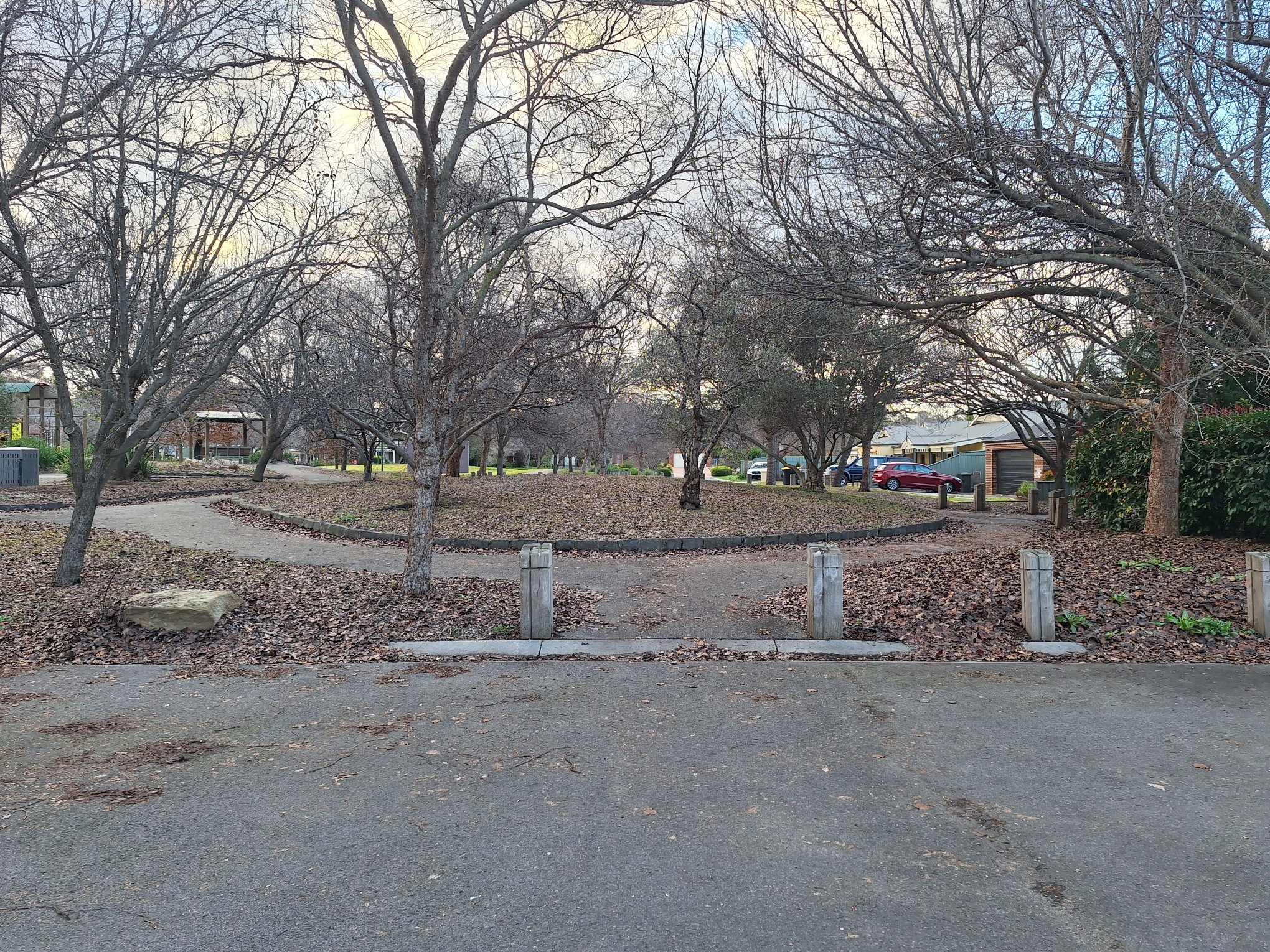
Example in East Hampton Place, Strathfieldsaye (road closure with walking and cycling access retained).
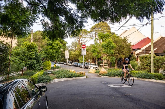
Example in Lawrence Street, Alexandria (road closure with cycling access retained). Source: Transport for NSW (https://www.movementandplace.nsw.gov.au/standards/...)
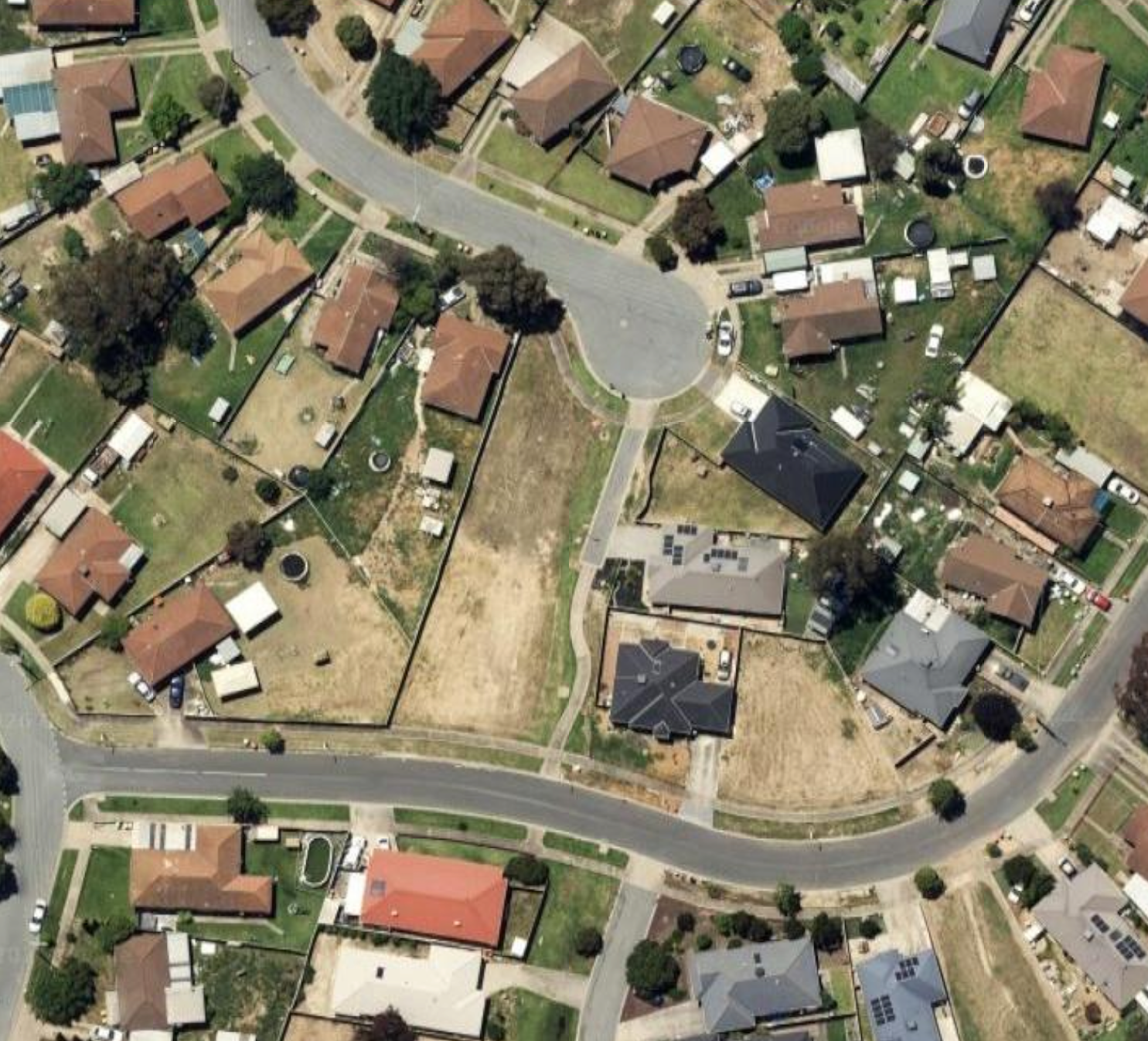
Example in Shepparton (cut through for people walking and cycling). Source: NearMaps.
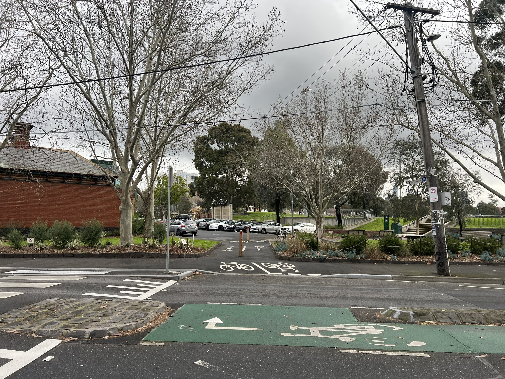
Example in Abbotsford (cut through for bicycles).
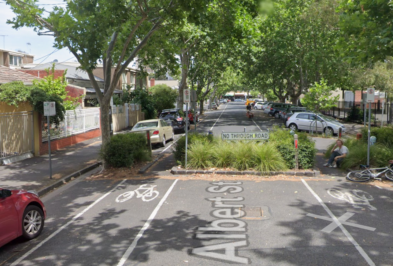
Example in Abbotsford (road closures with walking and cycling access retained). Source: Google Maps.
Place a marker on the maps on the streets or routes where you think a walking or cycling treatment should be. Your feedback will help the City identify and prioritise locations.
For each location, tell us:
You can add more than one pin. Add as many as you would like.
Walking is a person's most basic form of independent mobility and includes the use of aids such as frames, wheelchairs and motorised scooters.
Cycling includes all types of pushbikes used for everyday cycling, commuting, recreation and sport. This includes electric bicycles, tricycles, recumbent bicycles and cargo bikes which are all becoming more common.
Timeline item 1 - complete
Stage 1 community feedback opens
Thursday 20 August 2026
Timeline item 2 - complete
Stage 1 community feedback closes
Monday 21 September 2026
Timeline item 3 - active
Stage 1 community feedback reviewed
October - November 2026
Timeline item 4 - incomplete
Stage 1 findings shared with the community
November - December 2026
Timeline item 5 - incomplete
Stage 2 community feedback
February 2027
Timeline item 6 - incomplete
Final outcome shared with the community
May 2027
Have questions or want to learn more about this project, contact us below:
| Name | Active and Healthy Communities team |
|---|---|
| activeandhealthy@bendigo.vic.gov.au |